Emigrant Wilderness
Backpacking, Fishing, Hunting, Exploring
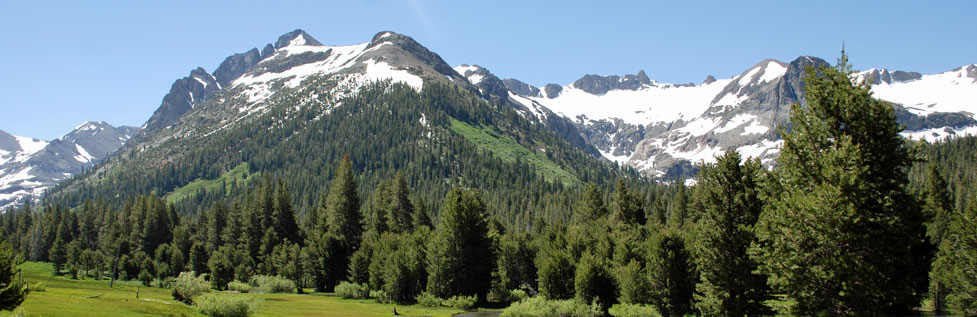
The Emigrant Wilderness spreads south of Sonora Pass on the western slope of the Sierra Nevada. The 112,000-acre wilderness falls within the Stanislaus National Forest and is bordered on the south by Yosemite National Park and on the east by the Hoover Wilderness.
Because so much of the granite in the Emigrant Wilderness was shaped, polished, and scooped out by glaciers, the area abounds with lakes from two-mile long Huckleberry Lake to hundreds of little lakes scattered over the landscape. Granite peaks and domes soar to 10,000 and 11,000-foot elevations. Miles of rivers and streams cascade from craggy heights and wind through meadows and forests. The two major river systems in the Emigrant Wilderness are the Stanislaus River and the Tuolumne River.
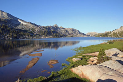
Emigrant Lake
The Emigrant Wilderness is popular with backpackers, hikers, anglers, horseback riders, photographers, and everyone who loves the outdoors. There are three major trailheads leading into the Emigrant Wilderness and a dozen other lesser ones. Trails from Kennedy Meadows lead up to Relief Reservoir and Kennedy Lake and off to more distant places such as Emigrant Lake and northern Yosemite.
Gianelli Cabin trailhead near Burst Rock is another favorite starting point. Trails from there wind out through Lake Valley and off toward Buck Lakes. The third trailhead which gets a lot of use is Crabtree Camp, not far from Gianelli's Cabin. Trails out of Crabtree Camp lead into the Cherry Creek area and across to Huckleberry Lake.
Shop Amazon: Backpacking Essentials
Elizabeth Wenk's Sierra North includes many trips in the Emigrant Wilderness. It makes a good reference when planning trips into the Emigrant Wilderness. This 2020 edition of Sierra North, written with Mike White, also covers hikes throughout the Northern Sierra Nevada.
Emigrant Wilderness Hikes with
Maps and Trail Descriptions:
- Crabtree Camp to Bear Lake - 3.5 miles
- Gianelli's Cabin to Chewing Gum Lake - 4.5 miles
- Gianelli's Cabin to Deer Lake - 12 miles
- Kennedy Meadows to Emigrant Lake - 14 miles
- Kennedy Meadows to Kennedy Lake - 7 miles
- Kennedy Meadows to Relief Reservoir - 4 miles
Carson-Iceberg Wilderness
The Carson-Iceberg Wilderness is spread along the crest of the Sierra Nevada from Sonora Pass north to Ebbetts Pass. Carson-Iceberg Wilderness was named after explorer and scout Kit Carson and the granite formation at the end of the Clark Fork Road known as the Iceberg.
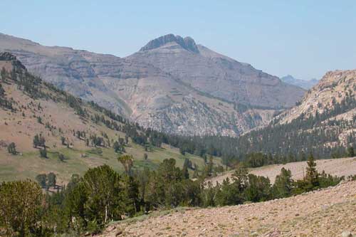
The Carson-Iceberg Wilderness contains 161,000 acres. Its highest peaks rise over 12,000 feet. Some of the main streams and rivers in the area include the northern tributaries of the Clark Fork of the Stanislaus, the headwaters of the Mokelumne River, and the tributaries of the East Fork of the Carson River.
The Pacific Crest Trail runs north and south through the Carson-Iceberg Wilderness, crossing both Sonora and Ebbetts passes. Other important trailheads into the wilderness include the Wolf Creek area, Rodriquez Flat and Mill Creek on the eastern Sierra, and the Clark Fork to the south.
Popular hiking destinations are the upper reaches of the East Fork of the Carson River, the Disaster Creek trail, and Silver King. Special fishing restrictions cover sections of the wilderness in order to protect the endangered Paiute trout.
Available at Forest Service offices is a
Carson-Iceberg Wilderness Trail Distances Map.
Carson-Iceberg Wilderness Hikes with Maps and Trail Descriptions:
Iceberg Meadow to Boulder Lake, 4 miles
Ebbetts Pass Trailheads into the Carson-Iceberg Wilderness
A number of trailheads that lead into the Carson-Iceberg Wilderness are found along Ebbetts Pass, Highway 4, to the north. The Ebbetts Pass to Sonora Pass trek makes a great 3-day outing. Other trails begin at Spicer Meadow Reservoir and Lake Alpine and wander south toward the Dardanelles. To learn more, visit our sister website Ebbetts Pass Adventures.
Hoover Wilderness
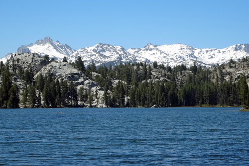
Fremont Lake and Tower Peak
The Hoover Wilderness is a narrow band stretching along the eastern slope of the Sierra in Mono County. The Hoover Wilderness's western boundary touches Yosemite National Park while its southern edge pushes nearly to Tioga Pass Road. Although only 48,600 acres in size, it contains dozens of lakes, deep, forested valleys, and high, spectacular peaks.
The most popular trailheads for entering the Hoover Wilderness are at Leavitt Meadow, Twin Lakes, Green Creek, Virginia Lakes, Lundy Lake, and Saddlebag Lake. Many backpackers push on over the crest of the Sierra into Yosemite National Park.
Hoover Wilderness Hikes with Maps and Trail Descriptions:
- Leavitt Meadow to Lane Lake - 3 miles