
Sonora Pass Day Hikes
From Easy Walks to Day-long Adventures
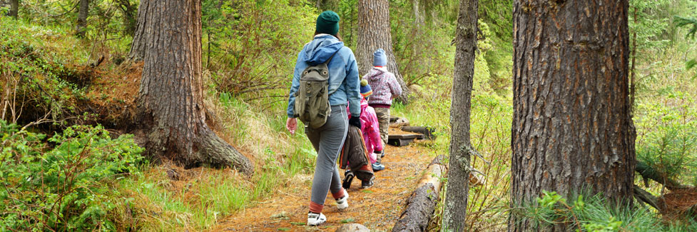
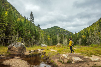
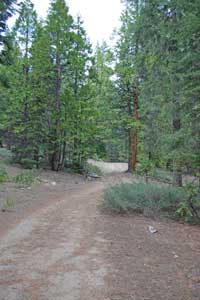
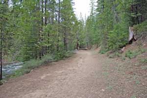
Sonora Pass day hikes are spread among trails around lakes, following rivers, and over forested ridges. Many of the backpacking trips listed on Sonora Pass Vacations also make good day hikes. The hiking trails shown below are among the best to be found in the Sonora Pass region, ranging from easy quarter mile nature trails to high elevation, day-long adventures.
Those who love the outdoors will find a wonderful variety of hikes along the Sonora Pass corridor. Many of the hikes are in the Pinecrest-Strawberry area, but others reach out into the wilderness regions, giving hikers a taste of the back-country. Wilderness permits are not required for day hikes, but for any extended day trips it is wise to check in the nearest ranger station of updated trail conditions.
Shop Amazon:
Day Hiking Gear
Day Hiking Gear
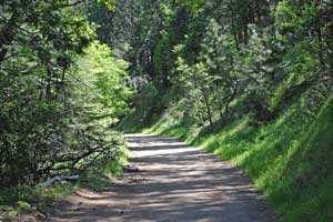
Pinecrest Lake Loop
Total distance: 4 miles, moderate
Elevation gain: 100'
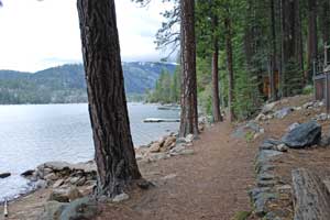
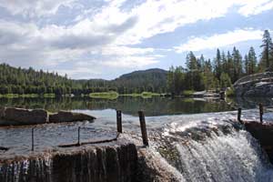
The Pinecrest Lake Trail (officially the Pinecrest Lake National Recreation Trail) is one of the most popular hikes in the area. Begin the 4-mile loop of the lake anywhere you please and set out in either direction.
Going counter-clockwise beginning at the Day Use Area, the trail skirts the southern edge of the lake, passing scattered summer homes. At the far end of the lake there are large, reasonably flat rocks worth venturing onto for great views back across the lake. A footbridge takes you over the South Fork of the Stanislaus, hardly more than a creek there. The section of the trail leading to the dam requires paying attention to your footing. Once across the dam follow the lakeshore back to the marina and around to the Day Use Area.
A restroom and day use area are now available at the east end of the lake.
Pinecrest EcoTrek
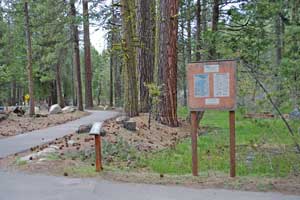
Total distance: 1 mile, easy
Elevation gain: 0
The Pinecrest EcoTrek takes you from the entrance to Pinecrest Campground on a paved trail up to the fishing pier at the side of the lake. Along the way are 8 marked nature points of interest. A map of the EcoTrek trail can be purchased at the entrance station to the Pinecrest Campground for $1. The map is well worth the price because it includes a full map of the Pinecrest vicinity, pictures of wildlife and trees found in the area, as well as information about each of the 8 stops on the EcoTrek.
Shadow of the Mi-Wok
Total distance: 1/2 mile, easy
Elevation gain: 50'
The Shadow of the Mi-Wok trail begins across the road from the Summit Ranger Station at the Pinecrest Y. Park in the Ranger Station parking lot, pick up a free flyer from the station, and then cross the road to the start of the trail.
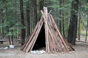
The short trail winds through the trees offering examples of Mi-Wok Indian life, from grinding stones to bark shelters.
Pinecrest to Strawberry
One Way: 1.8 miles, easy
Elevation loss: 300'
From Pinecrest Lake near the Marina follow the lake trail toward the dam. Cross over the dam and then turn left onto a trail descending along the side of the Stanislaus River. At first the trail may be difficult to follow, but simply watch for the orange blazes painted on the trees.
Soon the trail joins a dirt road. Follow it to the paved road (Herring Creek Road) which leads into Strawberry (about 1/4 mile of pavement). You could arrange to have someone pick you up there or, after getting a cold drink at the Strawberry Store, turn around and retrace your steps back to Pinecrest.
Herring Creek Reservoir
Total distance: .5 miles, easy
Elevation gain: 200'
The hike to Herring Creek Reservoir from the Herring Creek Campground is an easy half mile jaunt. Drive east from Strawberry on Highway 108, turn right onto Herring Creek Road and follow it 6.5 miles to the campground. Park nearby and hike up the dirt road to the reservoir. It makes a great picnic spot, swimming hole, and fishing destination.
TOP
Sugar Pine Railroad Trail
One way: 2.8 miles, moderate
Elevation gain: 500'
The Sugar Pine Railroad Trail follows the course of the old Sugar Pine Railroad that was used to deliver timber from remote regions of the forest to sawmills. Today its gentle grade makes it an excellent hiking and mountain biking route. Start at the Fraser Flat Road trailhead. To reach it take the Fraser Flat turnoff from Highway 108 located 6 miles east of Long Barn, just before reaching Cold Springs. Follow the Fraser Flat Road 2.5 miles down to the river.
Follow the trail upstream on the south side of the river. It goes about 2.8 miles up to where it connects with Old Strawberry Road. It's another 1.5 miles farther on the road to reach the Strawberry Store where you can buy an ice cream before heading back.
Confidence to Lyons Reservoir - Railroad Grade
One way: 4.7 miles, moderate
Elevation gain: 200'
This trail provides a gentle 4.7-mile climb to Lyons Reservoir following an old Sugar Pine Railroad grade. At an elevation of about 4,000' it is usually open by late spring. To reach the trailhead, take the Confidence South Fork Road off Highway 108 at Confidence. The road meets the Middle Camp Road. Turn left onto Middle Camp, but then soon afterward right again back onto the Confidence South Fork Road as it descends. Watch on your right for an unmarked dirt road.
In places the trail may pass through private property, so be sure to stay on the trail to respect property owners' rights. You can hike along dirt roads around the reservoir or explore connecting roads to other places.
Gianelli Cabin to Powell Lake
One way: 2.1 miles, moderate
Elevation gain: 500'
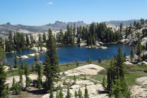
The Burst Rock trail from the Gianelli Cabin trailhead takes you on the route of the old emigrant trail used during the Gold Rush years. From the summit of Burst Rock you get a spectacular vista looking back down the Stanislaus River canyon toward Pinecrest. To reach the trailhead at Gianelli Cabin from Pinecrest, drive 2.8 miles up the Dodge Ridge Road. Then turn right and soon afterward left onto the Bell Meadow/Crabtree/Gianelli Cabin Road. Follow the road, which soon becomes a gravel road, 8 miles to Gianelli Cabin parking area. For anyone coming up Highway 108 from Twain Harte, turn 1.1 miles after Cold Springs onto Crabtree Road. Follow it 13 miles to Gianelli's Cabin parking area.
You can see remnants of the old cabin in the meadow. The trail leaves from the parking area and follows the contour of the ridge offering some great views of Burst Rock and then switch-backing up to the summit. The emigrants brought their wagons over the top of Burst Rock and down the slope toward Dodge Ridge and then Pinecrest. It's only a little more than a mile to the top of Burst Rock, elevation 9,100'.
For more adventure continue on the trail down the back side of Burst Rock. In less than a mile watch for the turn to the left leading you to Powell Lake. It's popular camping and swimming spot.
Leavitt Meadow to Roosevelt Lake
One way: 3 miles, moderate
Elevation gain: 500''
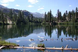
Roosevelt Lake and its sister Lane Lake make an enjoyable 3-mile day-hike destination on the east side of Sonora Pass. Begin at the parking lot next to the Leavitt Meadow Campground. Pass through the campground to the bridge across the West Walker River. Most of the hike follows the edge of Leavitt Meadow before climbing about 500' over a ridge and dropping down to the lakes. An alternative return route could take you past Secret Lake, adding only about a half mile to the hike.
Fishing is good in all the lakes. For those with a little extra time, visit the nearby beaver pond and follow the old, no-longer-maintained, hiking trail up to a gushing waterfall along a fork of the West Walker River.
Sonora Pass Pacific Crest Trail
One way: 5 miles, strenuous
Elevation gain: 1,500'
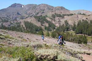
Heading south from Sonora Pass on the Pacific Crest Trail you climb 1,500' in the first two miles, but once you reach the top of that stiff ascent, you can walk for miles along the contours of the Sierra crest enjoying vistas both east and west. The trail traverses the flank of Leavitt Peak (11,569'), the highest mountain in the vicinity, and then follows the crest south. To the east you can look down on Leavitt Lake while to the west lies Kennedy Lake. The trail is best done in late summer when snow has left the trail and wildflowers are in bloom. You could hike out just 3 miles or make it a full day trip, going 5 or more. Carry water.
TOP