
Favorite Picnic Sites around Sonora Pass
From Lyons Reservoir to Leavitt Falls
Picnic areas (called Day Use Areas by the Forest Service) are scattered along Highway 108 from Pinecrest and Lyons Reservoir, up to the summit of Sonora Pass and down to Leavitt Meadow.
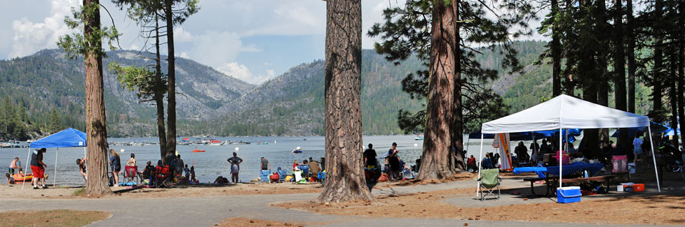
Pinecrest Lake Picnic Area
One of the favorite picnic sites around Sonora Pass is at Pinecrest Lake's picnic area (or "Day Use Area"), located adjacent to the lake with easy access to restrooms, the swimming beach, and a summer snack bar. The Pinecrest Lake picnic area has 50 picnic sites with grills, flush toilets and piped water. It is situated in a well shaded grove of towering pines. Some picnic tables are nearly at the water's edge. Dogs are not allowed.
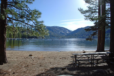
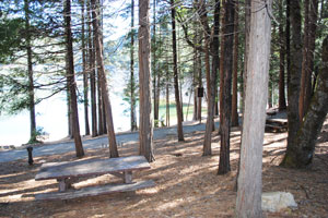
Lyons Reservoir Picnic Area
Another of the favorite picnic sites around Sonora Pass is at Lyons Reservoir Picnic Area. To reach it, go about 2 miles east of Mi-Wuk Village and watch for the signed road on your left. Follow the paved 2-mile road from Highway 108 to Lyons Reservoir. There you will find a single picnic table in a nice setting beside the lake. No physical contact (swimming, wading, etc.) is allowed with the water because it is a drinking water supply. Fishing from the shore is permitted. Easy hiking abounds along old railroad grades which connect with the reservoir. Railed walkways by the dam lead to scenic viewpoints, especially interesting when water is spilling from the dam. There is a vault toilet by the parking lot. The area is open from dawn to dusk. During the summer the gate on the road usually closes at 8 pm.
Cottonwood Creek Picnic Area
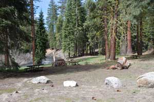
The Cottonwood Creek Picnic Area is located on the bank of the Clark Fork 4.8 miles from the turnoff from Highway 108. There are about 8 picnic tables, some in the clearing and others scattered among the trees. There is a vault toilet. The area offers good fishing in the Clark Fork. No nearest hiking trail is the Arnot Creek Trail about 2 miles east of the picnic area. The elevation there is 5,900 feet so it usually isn't clear of snow until mid-May.
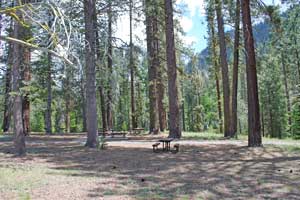
Beardsley Day Use Area
The Beardsley Day Use Area is on the shore of Beardsley Reservoir at Beardsley Point. There you will find pedestal BBQs, 16 picnic tables scattered through the trees, flush toilets, and a nature trail. To reach the picnic area drive 3.7 miles east of Strawberry and turn left onto the Beardsley Reservoir Road. Follow it 8.5 miles to the picnic area on the south shore. The area is open from 6 am to 10 pm. A designated swim area with a sandy beach is next to the picnic area.
Douglas Flat Day Use Area
Douglas Flat Day Use Area is located along the Middle Fork of the Stanislaus River near Dardanelle, 25 miles east of Pinecrest. It has picnic tables and a restroom. It makes a nice place to stop on a journey over Sonora Pass. Fishing in the Stanislaus River is close by.
A paved trail leads down to the Stanislaus River where a pair of benches are set with nice views of the river. The benches were erected in memory of Bradford York who used to do living history presentations for the Stanislaus National Forest.
Columns of the Giants Picnic Area
A picnic area is available adjacent to the parking lot at Columns of the Giants nature trail. Vault toilets are provided. The site is away from the highway among the trees and close to the river.
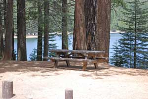
Sonora Pass Picnic Area
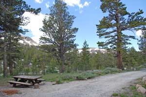
The Sonora Pass picnic area is situated at the top of Sonora Pass. Watch for the road just a quarter mile down on the western side of the pass. Picnic tables there are spread through a grove of trees with parking slots available for each site. A vault toilet is nearby. It can be windy and chilly exposed there on the summit of the pass, but the views are spectacular. You can look off the eastern side toward Bridgeport Valley and down the western slope into the rugged Deadman Creek canyon. The Pacific Crest Trail passes there, leading off to the north and south.
Leavitt Falls Picnic Area
This beautiful setting is on a ridge overlooking Leavitt Meadow and with a great view of Leavitt Falls. Drive 1.3 miles west from the Leavitt Meadow Pack Station, watching for a sign and turnoff on your left. A short trail leads to the falls overlook. The falls drop about 250 feet in several steps. Picnic tables and vault toilets are available at the site.
TOP

Explore scenic Sierra day hikes from Sequoia National Park to Yosemite and Lake Tahoe.