Hull Creek and Trout Creek
The Hull Creek and Trout Creek is another of the popular OHV sites around Sonora Pass. Hull Creek and Trout Creek have 20 miles of marked and maintained trails. To reach the area, turn off Highway 108 at Long Barn Road and connect to the North Fork Road. Drive 2 miles. At elevations from 4,500' to 7,600' it is usually open by mid-June.
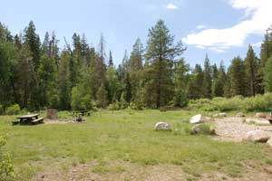
The Hull and Trout Creek area southeast of Long Barn is a popular area for all terrain vehicles and four-wheel drive users to operate with 20 miles of signed trails and 100 miles of roads open to OHV use. Few single-track dirt bike trails currently exist. The riding area ranges in elevation of 4500 feet near Long Barn to 7600 feet at Bourland Mountain. The riding area is closed during the winter due to snow blocking access. Hull Creek campground is nearby with 19 units, restrooms, and drinking water. Adjacent areas offer no-service, but have dispersed camping opportunities.
Niagara OHV Area
Niagara Creek OHV Campground
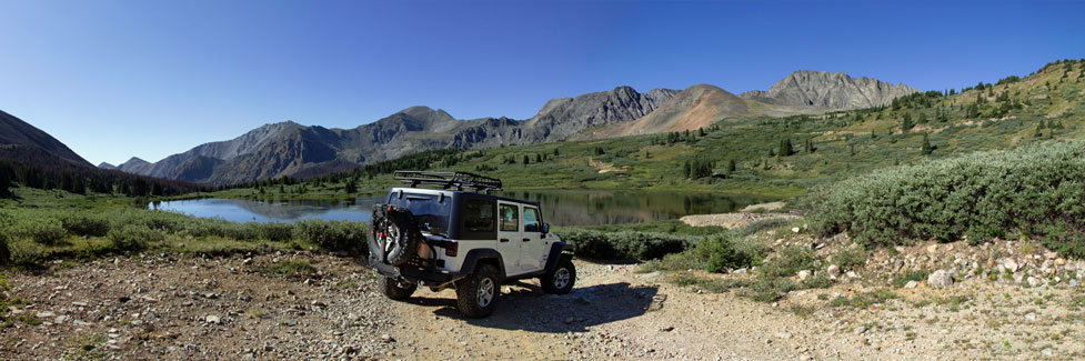
One of the leading OHV sites around Sonora Pass is located on Niagara Creek. The Niagara Creek OHV area offers a dedicated OHV campground and 5 miles of trails at an elevation ranging from 6,000 to 8,000 feet. It is usually open by mid-June, depending on the snow melt. To reach it drive 13.5 miles east of Strawberry on Highway 108. Turn at the Eagle Meadow Road and follow it 2.5 miles to the campground. The 6.4-mile Niagara Rim Trail is popular with 4-wheelers. Modified 4x4 vehicles are best for this trail.
4x4 In Motion, based in Stanislaus County, helps to maintain the trail.
Crandall Peak and Deer Creek
Crandall Peak is a popular motorcycle riding area with 40 miles of signed trails and 140 miles of road open to OHV use, extending from north of Crandall Peak to the Deer Creek area northwest of Highway 108. You'll see all sorts of Suzukis, Kawasakis, Yamahas and Hondas buzzing around there. To reach it turn off Highway 108 onto the Spring Gap Road and follow it 7 miles.
The riding area ranges in elevation of 3,500 feet at Deer Creek to 5,500 feet at Crandall Peak. Four-wheel drive and ATV trails are limited, but use is allowed on the 140 miles of road. A camping area located at Crandall Peak near Spring Gap off Forest Roads 4N01 and 4N88, accesses these routes and offers dispersed camping and vehicle parking/off-loading with restrooms, but no other services or potable water is available. Trails in the Crandall Peak area are usually closed in the winter due to snow blocking access. Four-wheel drive and ATV trails are limited in the riding area, but use is allowed on the 140 miles of road.
You might not guess from the title and front cover of California Trails Northern Sierra Region that it's an 4-Wheeling book. It covers Crandall Peak, Clavey, and other local backroads.
Hunter Creek
The Hunter Creek OHV Area is east of Tuolumne City at elevations between 2500 feet and 5800 feet at Duckwall Mountain. The area features 100 miles of trails that are open year-round as long was weather permits. Trails are limited to motorcycles, ATVs, and OHVs. Camping is available at the River Ranch Campground from March until November 1. Dispersed camping is available nearby.